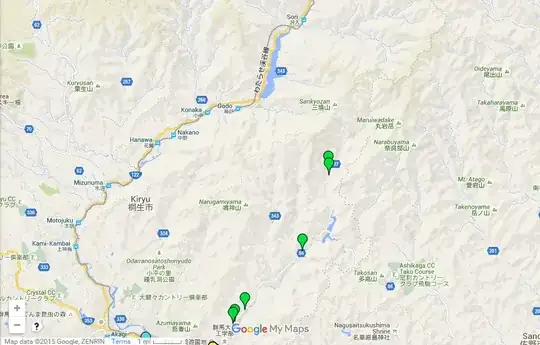
Now that my schedule has freed up a little, I reran my search for 聖地巡礼 悪の華. (I don't really know Japanese, but the former seems to be a good search term for pilgrimage.) Maps such as this one came up, and I found this blog post for the corresponding episode (i.e. episode 10). (I had "misplaced" this episode when I commented on this question earlier, which was probably why I couldn't give a quick answer.)
Here's a screenshot of the map. The markers for episode 10 locations are in green and are isolated from the main "cluster"---I am reproducing the section in question below:

So it looks like Kasuga and Nakamura started on Prefectural Route 66 before branching onto Prefectural Route 337. There are also some "real life v.s. anime" comparisons on the blog I linked to, which verify the locations listed here. It is not clear to me if Kasuga and Nakamura are climbing any specific mountain; it looks more like they are travelling north via some mountainous roads. Northwards, there seem to only be more mountains.
(I should note that it isn't entirely clear if the rotoscoped locations in the anime are supposed to correspond to specific locations in the manga---it is possible that some of the locations in the manga were intentionally ambiguous, and that anime producers were forced to choose one location or the other. However, it seems that the best we can do is use the information from the anime; I don't recall any more specific information being released.)
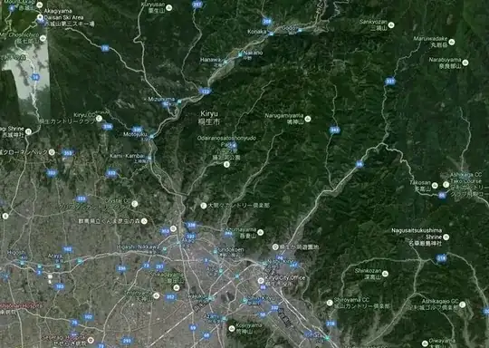
Incidentally, Google maps suggests that it is relatively easy to travel from Kiryu to larger cities such as Tokyo through flat land---it's not even as if the town is completely surrounded by mountains. More likely, the mountains take on some symbolic meaning for Kasuga.

